Hushan Hiking Trail (Nangang Mountains)
南港山系 虎山親山步道· Hiking trail
About
Hushan is one of the low hills in the Sishoushan City Forest. Together with the Nangang Mountains behind it, it forms a barrier along the south-east side of Taipei.
Read more
It rises 140 metres above sea level. Geologically it is a cuesta of marine strata, higher in the west and lower in the east, with wide views. A sundial on the summit tells the time by the sun. The trail runs over interlayered blocky sandstone and shale. The Hushan Stream flows through, and its ravine habitat supports fireflies, small green frogs, ferns and other wildlife. After the stream banks were repaired and reinforced and soil and water conservation was improved, the stream became a place to observe wetland ecology. Interpretive signs and route markers are set up along the trail. After renovation, the Sishoushan trails were named the Sishoushan City Forest. It takes in four hills named after the tiger, leopard, lion and elephant, and the area has many species of wildlife and birds. The city government's 產業發展局 restored the upper and lower reaches of the Hushan Stream, making it a small garden rich in aquatic life. Fireflies, tree frogs and other aquatic animals and plants can be seen in the trees and the stream. Hushan 120 Highland, with an old arsenal as its landmark and wide views, is a hilltop park named after its altitude. It is planted with neat trees and flowers, and pavilions give shelter from sun and rain. Hikers often stop here to look at the view and chat. Part of the Hushan Hiking Trail is built with eco-friendly materials, and a platform along the way has a rest plaza and a pavilion. The plaza is decorated with carved stone pillars of the four beasts: tiger, leopard, lion and elephant. It suits walks and group activities. Near the start of the climb there are snack stalls, vendors and coffee kiosks, and braised snacks and vegetarian snacks are sold beside Cihui Hall. A sign reading "Sishoushan City Forest" stands at the trailhead. The trail climbs gently beside the stream through the woods. The Hushan trail lies on the east side of Sishoushan. At Fuxing Garden the view opens up over the Taipei Basin, taking in eastern Taipei and neighbouring Baoshan. Looking west from here, Fengtian Temple stands at the position of the tiger's head, and the ridgeline behind it rises and falls like waves, like a crouching tiger about to leap. Because the hill is next to the Xinyi Planning District, the 101 tower stays in view along the trail even though Hushan is only 140 metres high. There are viewing areas and rest pavilions along the way, most of them on the stretch from Hushan Peak to Fengtian Temple. Near the top of Hushan is a pavilion with green pillars and a white roof, followed by the summit viewing platform. With the help of the interpretive sign there, the cuesta landform, high in the west and low in the east, is clear to see. Further on, a steep slope drops sharply down the hillside and has to be descended slowly and carefully using a rope. A pavilion ahead offers a rest. The trail continues to Hushan 120 Highland, which looks over the Xinyi Planning District and the 101 tower, with Songshan and Nangang to the right and Wuzhishan, Qixingshan and other mountains in the distance. Birds of prey, rare in the city, can be seen overhead. A key feature of the trail is the view down over Taipei's busiest district. The route has many plant species, and interpretive signs along the trail allow a self-guided nature walk. The Hushan Stream runs along the first part of the trail. The valley's terrain and humidity suit moisture-loving, shade-tolerant plants such as elephant's ear (姑婆芋), and ferns grow well here: Hushan alone has about 70 fern species. The Hushan Stream was once a natural wild stream. Coal mine waste dumped in earlier years created a risk of collapse, and with poor soil and water conservation the streambed suffered increasing erosion and silting. After work by the city government's 建設局, the original ecology has recovered and soil and water conservation has improved. Making use of the terrain, the waterside area has a stone bridge, water-play platforms, a water pump and a waterside park. The old coal waste site has been kept as an example for environmental education, and a sign near the entrance explains how stepped drop structures serve both conservation and soil and water protection. The Hushan Stream trail is paved with stone steps, with small ornamental railings along the stream. From April and May onwards fireflies can be seen. Besides the native land-dwelling black-winged firefly and red-chested black-winged firefly, released larvae of the aquatic yellow-edged firefly have bred successfully here. Fireflies can be watched at night.
Translated and shortened by DealTaipei from Taiwan's national tourism database. Sources are on the terms page.
Facts and sources
- Names
- EN Hushan Hiking Trail (Nangang Mountains)中文 南港山系 虎山親山步道한국어 후산 등산로 Chinese from the listing; English by DealTaipei
- District
- Xinyi District · 信義區 Tourism Administration listing, updated 2026-05-22
- Opening hours
- Not in the listing Tourism Administration listing, read 2026-09-30
- Phone
- (02)27593001 Tourism Administration listing. May be Chinese only
- Data
- /api/sight/hushan-hiking-trail-nangang-mountains.json The same facts as JSON, for apps and AI agents
Getting there


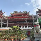 Songshan Cihui Temple Temple · 503 m away
 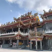 Songshan Feng Tian Temple Temple · 661 m away Yongchunpi Ecological Wetland Park Park and garden · 750 m away Hexing Coal Mine Historic site · 1244 m away Lishan Farmers' Plaza (Lishan Park) Park and garden · 1360 m away

Sources and photo credits are on the terms page.