Jinmianshan Hiking Trail (Wuzhi Mountains)
五指山系 金面山親山步道· Hiking trail
About
Jinmianshan is the south-west ridge of the Wuzhi Mountains and is divided into Jinmianshan and Xiao Jinmianshan. The andesitic sandstone in the mountain contains quartz, so when the sun shines the summit glitters when seen from a distance, and local people called it Jinmianshan ('golden face mountain').
Read more
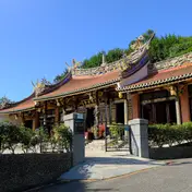
The climbing trail is about 2.3 km and the whole route about 3 km, taking about 1 hour 40 minutes on foot. The trail starts on Huanshan Road in Neihu, beside the university 德明財經技術大學. Near-vertical rock walls are visible from the start, and the route is lined with old sandstone steps. As the slope rises, the steps give way to large rock faces more than 100 m across. Halfway up is the stone lookout of a Qing-dynasty quarry, a clear landmark, and the boulders at the summit look out over the city of Taipei and the banks of the Keelung River. Walking east along the trail past Xiao Jinmianshan, you soon come out near Jinlong Chan Temple on Section 3, Neihu Road, the last part of the trail. Jinmianshan lies west of the Jinlong industrial road in Neihu. Seen from the direction of Bishanyan Temple, its summit boulders look as sharp as a bird's beak, so it is also called Jiandaoshishan ('scissors rock mountain'). Although only 258 m above sea level, it has the look of a high mountain. In the Qing dynasty its valley was where the large stones were quarried to build the city of Taipei. Large rocks rise and fall and stand steeply side by side, and quarrying marks remain. From the summit you can look out to Neihu Dapi and the streets of Taipei. The remains of the Qing-dynasty quarry are at a plain, even shabby-looking shelter halfway up the trail. It is a city-designated historic site and a witness to the building of Taipei: in the Guangxu reign of the Qing dynasty, most of the stone for the walls of Taipei Prefecture City was quartz sandstone taken from here, and the quarrying area ran from Jinmianshan east to Xiao Jinmianshan. Drill holes and neatly cut, scattered blocks can still be seen beside the shelter; this is the quarry site. At the trailhead, a steep, near-vertical rock wall rises above a stream beside the path. The old sandstone steps are wide enough for only one person, and before long large rocks appear on both sides of the path. As the slope climbs, the steps disappear and are replaced by layer after layer of rock faces more than 100 m across. The boulders that stood on either side now lie across the way ahead, and walkers must climb over this natural 'gym' to reach the top. Before the summit you can rest at Lunjian Pavilion, which is covered with scenery photos; at the fork, keep right and you soon reach the top and the Jiandaoshi rocks. The boulders here rise and fall; some stand steeply side by side and some rise like single pillars, and the summit is covered with piled rocks. Besides the unusual landscape, the Jiandaoshi rocks are a viewpoint. Halfway up, the Qing quarry and the stone lookout both look out over the Taipei Basin, with the banks of the Keelung River clearest. Among the summit boulders there is a 360-degree view: east to Neihu Dapi (Bihu Park), north to the hills near Bishanyan and the Wuzhi Mountains, south over the Keelung River, Songshan Airport, the 美麗華 Ferris wheel, the 101 tower and other parts of the city, and west over the Taipei Basin and the Keelung River. Just past the Jiandaoshi area, the ground glitters in the sun, and walking on the white sandstone ridge is like walking on a coast. This is because the andesitic sandstone here contains quartz. With boulders everywhere the soil is probably poor, and with a dry climate and strong winds, the plants that grow here must be hardy. On the ridge grow wind- and drought-tolerant plants such as 桃金孃, 車桑子, 細葉饅頭果 and 南嶺堯花. Near the quarry, 白毛臭牡丹 and 白桕 grow thickly, and 相思樹 trees are also plentiful on Jinmianshan. At Baijiuping, the first platform on the trail with a view over Neihu and the Keelung River, there is 白桕 and also a 刺葉桂櫻 tree, rare elsewhere and found only north of the Keelung River. On the way from the trailhead to the summit, trees that in other forests you can only look up at are shorter here, so they are easier to observe up close. There are several pavilions along the way for rests.
Translated and shortened by DealTaipei from Taiwan's national tourism database. Sources are on the terms page.
Facts and sources
- Names
- EN Jinmianshan Hiking Trail (Wuzhi Mountains)中文 五指山系 金面山親山步道한국어 진몐산 등산로 Chinese from the listing; English by DealTaipei
- District
- Neihu District · 內湖區 Tourism Administration listing, updated 2026-05-22
- Opening hours
- Not in the listing Tourism Administration listing, read 2026-09-30
- Phone
- (02)27593001 Tourism Administration listing. May be Chinese only
- Data
- /api/sight/jinmianshan-hiking-trail-wuzhi-mountains.json The same facts as JSON, for apps and AI agents
Getting there




Sources and photo credits are on the terms page.