Sinsin Park
新新公園· Park and garden
About
The park covers 25,408 square metres at Lane 149, Section 3, Nangang Road. The land was donated by the state-owned Taiwan Railway Corporation, and it lies within the East District Gateway Plan area.
Read more
It is planned as an ecological wetland park. Native plants and plants that attract butterflies and birds provide habitat, raise biodiversity and offer chances for environmental education. In response to global warming and more extreme weather, it has space for water storage and flood detention to keep water on site, as part of a 'sponge city'. Using the corridor created by putting the railway underground, it links public and private land from west to east as part of a multi-centred corridor urban structure, and serves as a park for both recreation and disaster prevention. Its children's play facilities, designed on the layered hill landforms of the north-east corner, include a climbing wall, slides, a zip line and balance beams, so that adults and children can play and enjoy the view together across the rolling landscape. The slide platform in the playground is the highest point of the park and looks out over the whole park.
Translated and shortened by DealTaipei from Taiwan's national tourism database. Sources are on the terms page.
Facts and sources
- Names
- EN Sinsin Park中文 新新公園한국어 신신 공원 Wikidata Q97349749, Chinese from the listing, Korean by DealTaipei (NIKL transcription)
- District
- Nangang District · 南港區 Tourism Administration listing, updated 2026-06-22
- Opening hours
- Not in the listing Tourism Administration listing, read 2026-09-30
- Phone
- (02)27853819 Tourism Administration listing. May be Chinese only
- Data
- /api/sight/sinsin-park.json The same facts as JSON, for apps and AI agents
Getting there


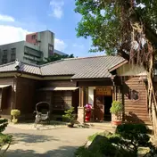 Jingxinyuan (Songshan Sanatorium Director's Residence) Historic site · 459 m away N24 Taipei Fangzhou Historic site · 697 m away Taipei Music Center Theatre and venue · 839 m away Foguangshan Taipei Buddhist Centre Temple · 1172 m away
Wikidata (CC0). Sources and photo credits are on the terms page.